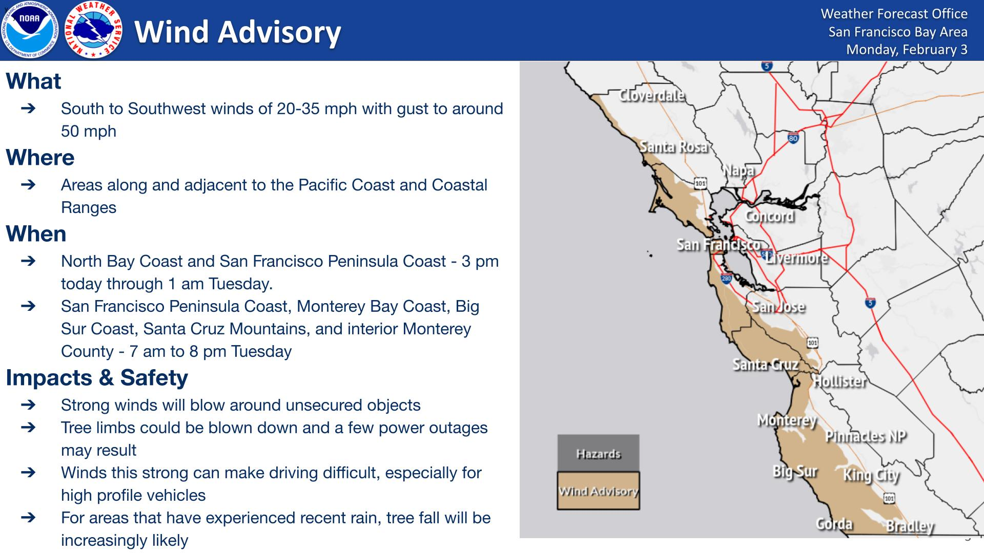
What is happening?
The National Weather Service forecasts continued rain systems that will increase in intensity starting Monday afternoon and continue through Wednesday morning. While rain intensity will lessen after Wednesday, continued precipitation is expected through the end of the week. In all, higher elevations could see up to 6” of rainfall, while valleys may experience up to 4” of rainfall. In addition, strong winds are expected Monday afternoon through Tuesday, with wind gusts up to 50 mph leading to downed trees and potential power outages.
Takeaways
- Between Sunday and Friday, Marin County could see between 4-6” of rain.
- Most intense periods of rain expected Monday afternoon through Wednesday morning.
- Wind Gusts are expected over 35mph leading to downed trees and potential power outages.
- Localized flooding in low-lying or poorly drained areas, such as freeway offramps, is likely.
What could this mean for Marin residents?
- Flooding: Minor flooding is expected in low-lying areas. Flooding of lots, parks, and roads with only isolated road closures expected.
- Road hazards: Excessive runoff may result in flooding of rivers, creeks, streams, and other low-lying and flood-prone locations.
- High water levels: Creeks, streams, and rivers may rise, possibly reaching flood levels. Flooding is a concern in areas prone to poor drainage and low-lying locations.
- Wind damage: Strong winds may knock down tree branches and blow around unsecured objects.
- Power outages: Heavy wind and rain could cause power outages.
What actions can I take to prepare and/or stay safe?
Before the storm
-
- Secure outdoor items: Tie down or bring in patio furniture, trash cans, and other loose items.
- Clear drains: Rake leaves and yard debris to keep gutters and storm drains clear. Place leaves and debris in green bin.
- Update your go bag & stay-box: Make sure you have flashlights, radios, spare batteries, and other essentials.
- Sandbags: Use sandbags to protect flood-prone areas of your home or business.
- Charge devices: Keep phones, backup batteries, and other electronics fully charged. Write down key emergency contacts in case your phone dies.
- Sign up for alerts: Register for emergency notifications at AlertMarin.
- Plan ahead: Talk to your employer about working from home, especially if you live in an area prone to road flooding.
- Stay informed: Visit Emergency.MarinCounty.gov for tips and resources.
During the storm
- Stay home if possible: Avoid unnecessary travel; wet and flooded roads can be dangerous and can prevent you from getting to your destination. Staying home is the safest option until the storm passes. If its an emergency, allow emergency responders to come to you.
- Drive carefully if you must go out: Go slow, keep headlights on, watch for obstacles, and leave extra space between vehicles. Do not drive through flooded areas or around barricades.
- Turn around, don’t drown: Never attempt to walk or drive through standing water.
- Stay clear of downed power lines: Treat all fallen power lines as live; call 9-1-1 to report them.
Stay informed: Monitor Emergency.MarinCounty.gov for the latest updates.